A bushwalk where you’d never expect it, the Two Valley Trail is a little slice of nature in the corridor between suburb and the busy Princes Highway. But, once you’re walking along it, both feel miles away.
Along the way, you’ll see historic cottages, classic bush tracks, huge boulders that are frequented by rock climbers and even a flying fox colony.
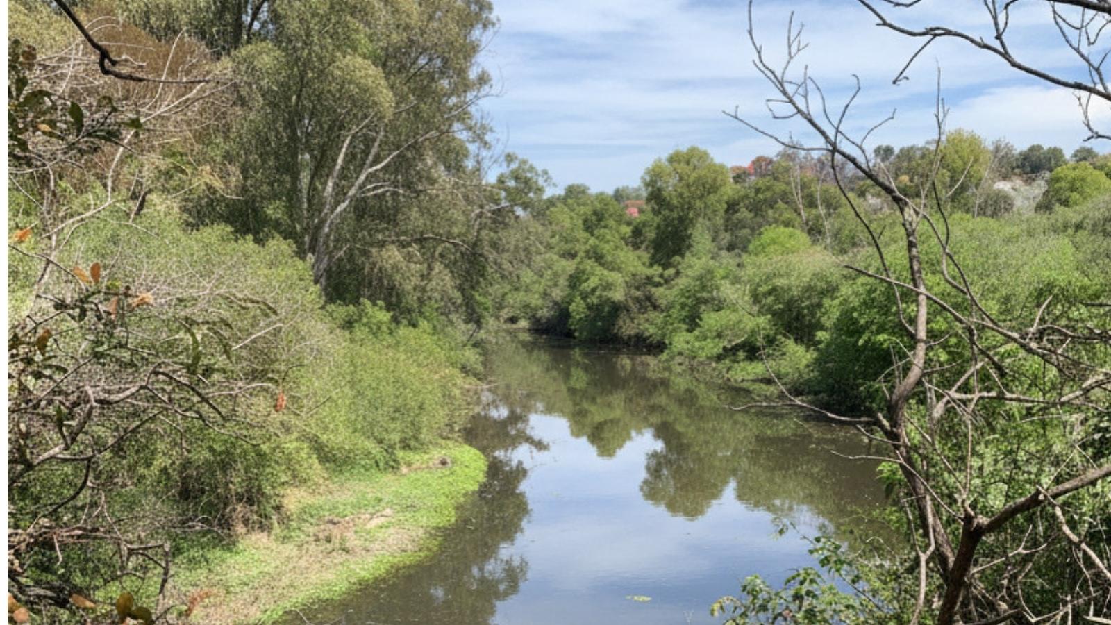
When we lived in Marrickville, this was a very frequented walk for us, and quickly became one of our favourite riverside walks. While the entire thing can stretch out to about 13km or more, we tend to do a round-trip 4km section. It’s great for lunch breaks on work-from-home days. Or, we pop over when the day was done for an evening walk when the days were longer.

Length of walk
The Two Valley Trail totals 13km (which is what’s mapped out by the local council above). It does pass through various parklands where you can start or finish though, if you want to shorten it. If you’re keen on a longer walk, you can continue further along the Cooks River, too.
The official walk begins at Beamish Street by Campsie Station and heads toward the Cooks River. It then follows the river east, all the way to Tempe, where the Cooks River meets Wolli Creek. From here, it turns west and follows the creek southwest toward Bexley North Station.
We usually start our shortened version of the walk at the end of Unwin Street in Earlwood. There’s an open gate to the beginning of the bush section of the walk at the end of the cul-de-sac. (It’s mostly paved walkway along the creek and Cooks River until this point.)
Difficulty
We rate this track a 3/5 in terms of difficulty. The bush track section of Two Valley Trail does have quite a few ups and downs along the way and is much more of a hiking trail than a wide-open fire trail.
The council doesn’t offer a track rating, however All Trails rates a few variations of this track all as Moderate. Here’s what it offers in terms of different lengths, too, in case you’re not keen on the full 13km:
- Wolli Creek Regional Park to Nanny Goat Hill (Turella to Bardwell Park): 3.4km
- Bexley North to Wolli Creek: 6.3km
- Wolli Creek Walking Track (Tempe to Bexley North): 10.6km

Terrain
There’s a good mix of terrains along this walk, from wide pavements to proper hiking tracks. If you don’t mind doing shorter sections, you’ll be able to do totally accessible walks, too. (We’ll explain which parts below.)
If you start along the Cooks River cycleway, anywhere between Campsie and Tempe, you’ll be able to walk along completely accessible pathways. These sections are ideal if you have any mobility devices (like prams or wheelchairs), or would like to ride a bike or scooter. The paved pathway continues around Waterworth Park (where the sports fields are) to Unwin Street. If you’re needing an accessible path, it’s probably best to turn around at this point. While paved, it’s a pretty steep incline and the section beyond here turns into a bush track.
From the cul-de-sac on Unwin Street to Jackson Place, you’ll be following Undercliffe Track. You’ll head through the woodlands from here and is clearly marked all the way.
There is a short stretch along Jackson Place that’s paved, too. Here, you’ll pass beautiful, historic, sandstone cottages before you re-enter the bush on Jackson Track. You’ll then cross over the grassy field at Turella Reserve before heading back into the woods at Girrahween Track. (In our view, this is the best section of the track)
Along this 1.1km section, you’ll pass by the Grey Headed Flying Foxes Camp, where there are hundreds (maybe even thousands) of flying foxes dangling from the trees all around. This is also where the large boulders and small cliffs make for some great rock climbing spots. While we’ve not tried it ourselves, we often do see people on the ropes here. Some of the nicest views of the river are round along this bit, too.
At Girrahween Picnic Area, the track opens up to a grassy area with some picnic tables, while up the hill you’ll find public barbecues, too. When doing the 4km walk, we use this as our turn-around point. But, we have continued on from here as well.
After the park, you’ll need to cross over Hartill-Law Avenue and follow Bray Avenue for roughly 150 metres where the trail resumes as the Bray Wetlands Track. From here, it winds its way through the bush and across Illoura Reserve before briefly becoming Bexley North Track and ending by the train station.

Wildlife and nature
For a walk so close to the city and tucked between suburbs, we love the amount of wildlife and nature we see here. There’s even a year-round Grey Headed Flying Foxes camp along the track. So, no matter when you do your walk, you’re pretty much guaranteed to spot them.
We’ve done this track dozens of times and always see plenty of them along the way.
Aside from the flying foxes, there’s plenty of birds and lizards in the area too.
Facilities and amenities
There aren’t any toilets along the bush sections of the track, but if you’re also doing the section along the Cooks River, there are a few along there. The last one is at Gough Whitlam Park. There’s also a canteen here, if you did want to stop for a bite to eat for a drink. We can also highly recommend the Concordia Club just across the river for a hearty, German feast, too!
There are a couple other cafes and eateries along the Cooks River section, including OL’ MATES Sandwich Shop and Wharf Street Kitchen (at Marrickville Golf Course).
Further along the track, there is a water fountain and playground at Turella Reserve, and public barbecues at Girrahween Park.
Getting there
This walk is quite accessible by public transport, as it passes a few train stations and is within a short stroll of a few more. Depending on where you want to start and finish your walk, here’s where you can take the train to:
- Bexley North: 250m from the end of the walking track
- Bardwell Park: 120m from Girrahween Track, or 250m from Bray Wetlands Track
- Turella: 250m from Turella Track, which meets up with the track in Turella Reserve
- Tempe: 230m from the Cooks River section of the track
The other stations along the way are currently closed while they’re being converted into the new Metro line. Once they re-open we’ll provide instructions for them, too.
If you’re keen to drive, there’s plenty of free parking street along the way. We usually park on Unwin Street in Earlwood and start from there. Depending on where is easiest for you to begin the walk, you can also park along Bayview Avenue nearby, at Turella Reserve, Girrahween Picnic Area or Bray Street.
What else do you need to know about Two Valley Trail?
Yes! Dogs are welcome on along the track, but must be on a lead. Wolli Creek Regional Park is not a national park, but it is maintained by New South Wales National Parks.
The Cooks River Cycleway is fully accessible and both pram- and wheelchair-friendly. Unfortunately, the rest of Two Valley Trail is through bushland and is not.
Nope! The track is completely free to use, and there are no parking fees on the surrounding streets.
Yes, but not very often. Keep an eye on the local preservation society’s website for upcoming walk schedules.