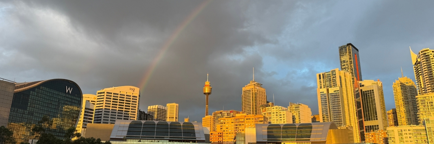
The beauty of living somewhere with a moderate climate is that our national parks, bush tracks and parklands are accessible year round. But, even we Sydneysiders tend to get a bit whingey about the still-quite-mild winter weather; especially on a windy day when temperatures feel like the single digits and the sun doesn’t warm us up quite as much as the summer months.
If you’re still craving some time but the water, but don’t want to head to the coast, read on.
Perfect for a winter weekend, each of these walks offer all the tranquility of being by the water without the brisk, salty winds coastal walks tend to bring during the cooler months.

Lady Carrington Drive
Where is it? Royal National Park, starting from Audley
How to get there: You can only get to this walk by car, parking at the visitors centre in Audley. There is no public transportation.
Park fees: $12 per vehicle, per day
How long is it? Up to 20km total, but as it’s an out-and-back trail you can make it shorter
Is it pet friendly? No, as it’s entirely in a national park.
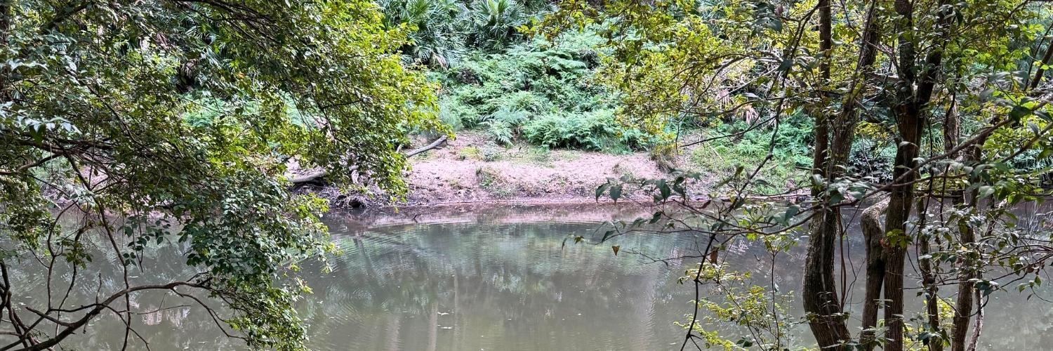
Following along the Hacking River, Lady Carrington Drive isn’t so much a road as it is a fire trail. It’s relatively flat along the way with pretty compact gravel, making it accessible for those who struggle with steps or rough tracks. We passed mountain bikers along the way and think some prams may be able to make the journey too.
Starting from Audley, the trail starts just passed Varneys Bridge and continues for about 10km. It is just an out-and-back track, so if 20km is a bit too long, you can turn around at any point. We were a bit short on time during our visit, so walked out 4km before turning around for a walk totalling 8km.
Along the way, you’ll pass by a few rocky overhangs and plenty of lush bushland with peeks of the Hacking River every so often.
While we were there on a weekday, we only passed two other people during our two-hour walk. So, not only in scenery, but also in crowds it was a totally different to some of the park’s popular coastal walks.
Read more about this walk on All Trails

Lane Cove Riverside Walk
Where is it? Lane Cove National Park
How to get there: You can take the 256 or 516 bus from Chatswood, then walk into the park. Or, you can drive.
Park fees: $8 per vehicle, per day (it’s free to walk in from the bus stop)
How long is it? Up to 19km total, but there are a few options to make it shorter
Is it pet friendly? No, as it’s entirely in a national park.
Just minutes from the office buildings and shopping centres of Chatswood sits Lane Cove National Park with 670 hectares of tranquil bushland. Lane Cove River slices the park in two, and along both sides there are plenty of places to relax, launch a kayak or take a walk.
There are actually two main tracks you can choose from here, one that is flatter and passes through mostly picnic areas, or the more scenic and more challenging bush track. There are bridges available at both ends too, adding a third option that’s a loop combining both paths.
We tend to favour the rougher side as it’s more scenic and has more of that hiking experience that we look for in a national park, but both are great options. If you do opt for the Riverside Walking Track side, this is where you’ll find established picnic areas and more public toilets along the way.
Read more about these walks on All Trails: Riverside Walking Track, Lane Cove to Epping, Lane Cove Riverside Walk (Loop)

Two Creeks Track
Where is it? Garigal National Park
How to get there: You can take the 260, 270, 271, 274, 278, 279, 280, 281, 283 or 284 bus, or you can drive.
Park fees: None.
How long is it? Up to 13.7km, but as it’s an out-and-back trail you can make it shorter
Is it pet friendly? Yes! For part of the walk at least, from Babbage Road until the sign for the national park a few kilometres in.
There’s something we always find a bit special about this walk. The tranquility of the blue-green creek as the sound of cars disappears makes it feel like you’re walking into the wilderness… and not just in another Sydney suburb.
While there’s a few paths that join up to this track from nearby streets, we always start our walk at the end of Babbage Road, just before the Roseville Bridge. There’s plenty of free parking here and even a cafe at the nearby marina.
Once you’ve passed under the bridge, the noise of vehicles passing overhead quickly drops away and you’ll find yourself walking along a well-maintained and relatively flat track. It follows the water and side creeks for quite a while, so if you’re looking for a nice, long walk that isn’t strenuous, this is it.
A few kilometres in, Two Creeks Track does enter Garigal National Park, where it then become a pets-free zone. So, if you are taking your dog along with you for the walk, just keep an eye out for signage. This will need to be your turn-around point.
See our in-depth guide to Two Creeks Track | Read more about this walk on All Trails

Cooks River Short Loop
Where is it? Marrickville and Tempe
How to get there: You can take a train to Tempe Station, the 423 bus to the bridge at Illawara Road or you can drive. There is some parking in Steel Park Car Park or you can park for free on the street.
Park fees: None.
How long is it? 3.1km for the short loop, but can extend this to up to 22.9km along the entire Cooks River Cycleway
Is it pet friendly? Yes! The walk isn’t part of any national park.
During our few years living in Marrickville, this was a frequently walked track for us. Perfect for lunch time strolls or after-work walks, this walk takes less than an hour if you stick to the short loop. But, you can continue further along the Cooks River Cycleway to make it up to a huge 22.9km.
The entire short loop, from the Illawarra Road bridge to Tempe Station is paved and accessible for bikes, scooters, prams and wheelchairs. If you’re continuing west past Illawarra Road, make sure to stick to the south side of the river if you’re on wheels. You can walk through the golf course on the other side, but it’s not a paved path and can get muddy or have exposed tree roots.
One of the best parts of this walk, though, is the proximity to Marrickville’s cafes for a pre- or post-walk coffee.
Read more about this on All Trails

Two Valley Trail
Where is it? Earlwood, Wolli Creek and Turella
How to get there: You can drive to Unwin Road, start mid-trail with a short walk from Turella Station or Bardwell Park Station.
Park fees: None.
How long is it? Up to 10.6km, but as it’s an out-and-back trail you can make it shorter
Is it pet friendly? Yes! Although managed by NSW National Parks, it’s a regional reserve and not a national park.
Wolli Creek is so much more than apartments, a Woolies and endless Asian restaurants. The creek itself actually sits within a regional reserve with a few bushwalking tracks that offer a quiet space away from the busy suburb’s hub.
While the entire walk stretches to about 10km return, we tend to favour a shortened 4km version as it was perfect for lunch breaks while we lived in Marrickville. Starting at the end of Unwin Street, we’d follow the Undercliffe Track portion of the Two Valley Trail to Illoura Reserve.
In this stretch, you’ll pass by a few beautifully maintained sandstone cottages on Jackson Place and a grey-headed flying fox camp, that’s home to hundreds (maybe thousands?) of the animals.
If you’re into rock climbing, this is also a popular spot to scale up some of the small cliffs in the area. There’s usually a few people on the ropes here when we walk by.
See our in-depth guide to Two Valley Trail | Read more about this on All Trails

Berowra Waters
Where is it? Berowra
How to get there: You can take a train to Berowra Station and walk to the start of Berkley Trail, or you can drive if you’re starting at Berowra Waters.
Park fees: None.
How long is it? Up to 12.7, depending which track you choose
Is it pet friendly? No.
For a selection of walks that will get your heart pumping, Berowra is a great place to explore. The area is quite hilly, with plenty of valleys leading down to rivers and creeks, and has loads of bushwalking trails that you can follow or interconnect to make your own adventure. Here are a few that we’ve done and would happily do again.
Berowra to Crossland is a 12.7km trail takes you along a section of the Great North Walk where you’ll walk along both Berowra Creek and Calna Creek. With some overlap, the 12.4km Berowra Waters to Crossland Reserve walk offers a steeper crack for those after a more intense hike. If you’re after a more leisurely pace and more firetrails instead of bush paths, Crowley and Berkley Trails is about half the length at 6.4km and features more lookout points out toward the water rather than riverside track.
A few of these are even accessible via public transport, with Berkley Trail (which is also used in the Berowra to Crosslands walk) is a walkable from Berowra Station.
Read more about these walks on All Trails: Berowra to Crossland, Berowra Waters to Crossland Reserve, Crowley and Berkley Trails.