Take in unrivalled city and harbour views, spot whale fins flapping against the deep-blue Pacific, and take a dip in clear-blue waters. You’ll be treated to all of that and more by walking along these Sydney coastal walks will never feel like exercise.
Okay. Maybe a little. But the stunning views are well worth the trek, we promise.
Starting from a short-and-sweet 2.1-kilometre stroll to a weekend-long 27 kilometre trek, there’s plenty of options for coastal treks in Sydney that are fit for all walks of life.
Hermitage Foreshore Walk
Where is it? Vaucluse, starting at the east end of Rose Bay or in Nielsen Park.
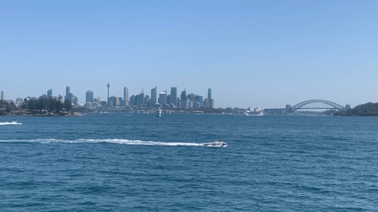
How long is it? 2.1 kilometres each way
Why should I bother? This relatively flat walk follows the coast along the harbour with clear views toward the city. There’s a few cute, little harbour beaches along the way – including Milk Beach – which are perfect for quick dips. I’d recommend starting at the Rose Bay end, taking a break at Nielsen Park for a swim and a bite at the kiosk before returning to Rose Bay.
How do I get there? Park at Rose Bay, or take a bus along New South Head Road (324, 325, 386) and walk down Bayview Hill Road to the beginning of the track
More info: All Trails | NSW National Parks

The Coast Walk
Where is it? In Royal National Park, starting at the end of Beachcomber Avenue in Bundeena and ending at Otford (or reverse).
How long is it? 27 kilometres one way, or it can be broken up into smaller sections. Bundeena to Marley Beach or Wattamolla to Eagle Rock are popular options – and for good reason.
Why should I bother? The iconic coastal track is within (relatively) easy reach of Sydney, but offers incredibly diverse sections of terrain. You’ll walk along rocky outcrops, along cliffs being crashed with raging waves, through bushland and pass through the aptly named “Palm Jungle”. There are also multiple beaches and swimming holes along the way. You can either walk it all in one day or you can overnight at North Era Campground.
How do I get there? If you’re driving, you can park at either end of the track. But, if you’re planning on doing the whole one-way walk, make sure you organise a pick-up at the other end as there’s no easy way to take public transport between the two. If you’re doing out-and-back walks along the track, you can take public transport to Bundeena (via ferry from Cronulla) or to Otford (via train to Otford Station).
More info: All Trails | NSW National Parks

Taronga Zoo to Balmoral Beach
Where is it? In Mosman (or Balmoral), following along Sydney Harbour starting at Taronga Zoo Wharf and ending at the beach in Balmoral. The walk can also be done in reverse or joined onto via off-shoot tracks to nearby streets.
How long is it? 6 kilometres one way
Why should I bother? If the journey across the harbour from Circular Quay to the zoo isn’t reason enough, this Sydney coastal walk along the coast is truly spectacular. It begins with views toward the CBD, Sydney Opera House and Sydney Harbour Bridge and continues to travel into picturesque bays, popular parks complete with cafes and eventually up on a ridge overlooking North and South Head where the harbour spills out into the sea.
How do I get there? If starting at Taronga, you can either take the ferry across from Circular Quay or take the 238 bus. If you’re starting at Balmoral, the 114 to Royal North Shore Hospital or the 238, if you’re making a return trip to the ferry, are available. Alternatively, if you haven’t had quite enough exercise yet, you can walk (uphill!) to Military Road and catch a bus from there.
More info: All Trails

Two Creeks Track
Where is it? Along the west side of the water from Roseville Bridge. You can continue walking along the waterside track up to Garigal National Park.
How long is it? Being an out-and-back track, it can be up to 13km depending where you turn back. Turning around shortly after the national park’s welcome sign tracks the walk at about 8-9km return.
Why should I bother? A bit of a hidden gem, this quiet track follows the creek away from the bustle of the Roseville Bridge and into the bush along Middle Harbour. The track is wide in most places, relatively flat. It has some lovely scenery along the way, including rocky overhangs, wide creeks that are begging to be kayaked through and the rolling hills that flow into Garigal National Park, as you get further in.
How do I get there? You can drive to the end of Babbage Road and park for free on the street. Unfortunately, there’s no public transport that takes you to the beginning of the walking track.
More info: All Trails

Cape Baily Track
Where is it? In Kamay Botany Bay National Park, on the Kurnell side. It can be accessed from Cape Solander.
How long is it? Officially, it’s 6.4 kilometres return to the lighthouse and back. However, it’s an out-and-back track, so you can make it shorter if you’d like. If you continue past the lighthouse, the track does go on and you can easily add an extra kilometre or two to your hike.
Why should I bother? Take in similar views to the Royal National Park, but with less than half the people. Not only is this walk closer to the city than the Coast Track’s national park, much fewer people come here. But, it’s actually one of the best places to go whale watching in winter. On a clear day, it’s common to see dozens or more water spouts and fins slapping the ocean.
How do I get there? End of Polo Street or from the visitor’s centre in the national park. Normally you can park at Cape Solander, where there’s a small car park area, but the section of road has been closed for months now due to construction. Public transport isn’t an ideal way to get to this track, but it can be done. You’ll need to take the 987 bus from Cronulla Station to Kurnell. Careful though, it only goes a few times per day.
Tip: For a longer walk, and one that adds a different type of terrain, you can continue past the lighthouse and around to Potter Point. You can also park nearby here at Voodoo Point. No national park fees are required to park here.
More info: All Trails

Bondi to Coogee
Where is it? From Bondi Beach to Coogee Beach (or just to Bronte, if you’re after a shorter walk)
How long is it? 6 kilometres each way from Bondi to Coogee, or about 2.5 kilometres each way if you’re just going to Bronte.
Why should I bother? Sydney’s most iconic coastal walk, this coastal trail will treat you to incredible views of the Eastern Suburb’s coastline. If it’s a hot day, there’s a total of six beaches (Bondi, Tamarama, Bronte, Clovelly, Gordon’s Bay and Coogee) you can take a dip at along the way.
How do I get there? It’s best to leave your car at home for this one, as parking at Bondi is never fun. Take either the 333 bus from the city or 380 from Bondi Junction to Bondi Beach and walk from there. If you’d like to start at Coogee, you can take the 373 or 374 from the city, or the 313 to Bondi Junction to Coogee Beach.
More info: All Trails
Want to try the paid version of All Trails, but aren’t sure you about it? Get a free 7-day Trial!
Accessible coastal walks in Sydney
Unfortunately none of the walks listed above are accessible. But, that doesn’t mean there aren’t any. If you’re looking for wheelchair- and pram-friendly strolls, here’s a few places you can go:
- Royal Botanic Gardens to Circular Quay: From Circular Quay to the Opera House and into the Royal Botanic Gardens, you can walk along the harbour without needing to step off paved paths. See the track on All Trails.
- Walsh Bay and Barangaroo Reserve: From Circular Quay all the way to Wynyard, you can take flat footpaths and boardwalks under Sydney Harbour Bridge, around wharves in Walsh Bay and around Barangaroo Reserve for an urban coastal walk.
Coastal walks with places to swim
Much of Sydney Harbour isn’t swimmable as there is heavy boat traffic. However, there are plenty of allocated swimming areas and harbour beaches well-worth checking out, especially to cool down from some of these walk. Check out the following beaches on these walks:
- Hermitage Foreshore Walk: Milk Beach, Shark Beach (Nielsen Park)
- The Coast Walk: Marley Beach, Little Marley Beach, Wattamolla, Curracurrang Gully, Garie Beach, Era Beach, Burning Palms Beach
- Taronga Zoo to Balmoral Beach: Taylor’s Bay, Chowder Bay, Balmoral Beach
- Bondi to Coogee: Bondi Beach, Tamarama Beach, Bronte Beach, Clovelly Beach, Gordon’s Bay, Coogee Beach
We don’t really recommend swimming along Two Creeks Track or Cape Baily Track. Kurnell and Cronulla Beach are closeby to Cape Baily if you do fancy a swim, though.